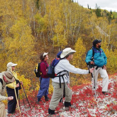
Hiking/Walking Trails
Discover the Eastern Manitoba section of the THE GREAT TRAIL (Trans Canada Trail) that will take you through three provincial parks, covering more than 600 kilometers.
Read time: 3 min
Discover the Eastern Manitoba section of the THE GREAT TRAIL (Trans Canada Trail) that will take you through three provincial parks, covering more than 600 kilometers.
Discover the Eastern Manitoba section of the THE GREAT TRAIL (Trans Canada Trail) that will take you through three provincial parks, covering more than 600 kilometers. The Border to Beaches trail (a Trails Manitoba – Trans Canada Trail initiative) starts from Grand Beach (Beaconia area) to Ontario Border near Falcon Lake area. The Red River North Trail Association Inc. has its Red River North Trail – over 400km long (also The Great Trail) and is the longest Active Transportation Trail in Manitoba and goes from Winnipeg to MacArthur Falls Area and goes through 10 municipalities including Grand Beach Provincial Park and Birds Hill Provincial Park. The trail has some portions of dual routing from Grand Beach to Lester Beach to Traverse Bay and Victoria Beach, and then cuts across Belair Provincial Forest to Stead and onto Powerview-Pine Falls and then south to Great Falls and MacArthur Falls area connecting to the Blue Water South Trail which goes through the Lac du Bonnet area connecting to the Pinawa Trail. Pinawa’s section winds from the Pinawa Dam Historic Site to the Seven Sisters Falls Generating Station. The North Whiteshell Trail section runs from Seven Sisters Falls to Caddy Lake to Rennie and connects to the Centennial Trail. The South Whiteshell Trail section runs from Centennial Trail to the Falcon Lake area and onto the Ontario border. Along the way you will find the Mantario Trail as a connection option.
Please note that The Great Trail has many sections still under construction. For information on different terrains and trail completeness, recommended uses and amenities visit www.thegreattrail.ca.
For other special events visit www.prairiepathfinders.mb.ca.
History of the The Great Trail
Initiated in 1992 as a project to celebrate Canada’s 125th year, the Trans Canada Trail was created as the world’s longest network of multi-use recreational trails. When completed, it will stretch 23,000 kilometers from the Atlantic to the Pacific to the Arctic Oceans, through every province and territory, linking over 1000 communities and all Canadians. The goal of a connected Trail as a continuous route from coast to coast to coast was completed by 2017, the 25th anniversary of the Trail and Canada’s 150th anniversary since Confederation.
Celebrate International Trails Day in June at various locations through Eastern Manitoba.
The Great Trail in Eastern Manitoba Start/End Distance
Also visit the Trails Manitoba website for more information.

Did you know that July is Ice Cream Month? And while Canadians may consume more ice cream in the harsh…

Are you ready for the Long Weekend? We sure are here in Eastern Manitoba.